Introduction
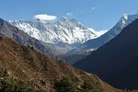
India has some of the highest mountain ranges in the world. The Great Himalayan mountain ranges are the famous and highest mountain hills of India. The Himalayan mountain range bisects India from the rest of Asia, this mountains is the primary source of mighty rivers in India. Himalaya is the youngest and the longest mountain range in India and has almost every largest peak of the world. While Himalaya is the youngest, the Aravalli Range is one of the oldest mountain range in the world.
The Himalayan Range
- Himalaya literally translates to “abode of snow” from Sanskrit.
- The Himalayas stretch across the north-eastern portion of India. They cover approximately 2,500 km and pass through the nations of India, Pakistan, Afghanistan, China, Bhutan, and Nepal.
- Nanga Parbat and Namcha Barwa is considered as the western and eastern point of the Himalayas.
- Various landforms like gorges, V-shaped valleys, rapids, waterfalls, etc. are indicative that Himalayas are still in young stage.
- The Himalayan range is made up of three parallel ranges often referred to as the
- Greater Himalayas,
- The Lesser Himalayas, and
- The Outer Himalayas.
- Mount Everest (Nepal) at 8,848.86 m is not only the highest peak in the Himalayas but the highest peak on the entire planet. Mount Everest is known as Sagarmāthā in Nepalese and Chomolungma in China.
- Nanda Devi, which is the 23rd highest peak in the world is located entirely within India. K2, which is situated in the north-eastern Karakoram Range, is located in the Gilgit–Baltistan region (PoK), while Mount Kanchenjunga is located at the border of Nepal and Sikkim. Kanchenjunga Main is one of the three peaks of Kanchenjunga located in India.
- The Himalayas are the source for the Indus, the Yangtze, and the Ganga-Brahmaputra. All three are major river systems for the continent of Asia.
- Himalayas also play a vital role in regulating the climate in northern India by preventing cold air from entering Indian mainland in winter season.
Karakoram Range
- Karakoram Range and Pir Panjal Range lies to the North-west and south of the Himalayan Range.
- A major part of the Karakoram Range lies under the disputed category of Indian and Pakistan and both countries have declared a claim over it.
- Karakoram Range, with a length of 500km holds many largest peaks of Earth. K2, the second highest peak of the world, at 8,611m lies in the Karakoram Range.
- Hindu-Kush, an extension of the Karakoram Range runs in Afghanistan.
- Karakoram has the most glaciers excluding Polar Regions. The Siachen Glacier and The Biafo Glacier, which are world’s 2nd and 3rd largest glaciers, are located in this range.
The Purvanchal Range
The Himalayas bend sharply to the south beyond the Dihang gorge and move outwards to form a covering the eastern boundary of the country. They are known as ‘the Eastern or Purvanchal Hills’.
- The Purvanchal Range or the Eastern Mountain Range comprises three parts: The Patkai-Bum Hill, The Garo-Khasi-Jaintia Hills and Lushai Hill (Mizo Hill).
- Mawsynram, in Meghalaya is the wettest place on Earth because of these hills and it lies in the Khasi Hill.
- This range covers all the eastern states of India, which are commonly known as the Seven Sisters.
- They extend over an area of about 98,000 square km in Arunachal Pradesh, Nagaland, Manipur, Mizoram, Tripura, and eastern Assam states.
- The area is bounded by Bangladesh to the southwest, Myanmar (Burma) to the southeast, and China to the northeast.
- The highest peak in the region is Mount Dapha (in Arunachal Pradesh), with an elevation of 4,578 metres.
- The Patkai and other associated mountain ranges (including the Mishmi, Naga, Manipur, Tripura, and Mizo hills) that run through this region are referred to collectively as Purvachal (Purva, “east,” and achal, “mountain”).
- Daffla Hills: It is situated to the north of the Tezpur and North Lakhimpur, and is bounded on the west by the Aka Hills and on the east by the Abor Range.
- Mikir Hills
- A group of hills located to the south of the Kaziranga National Park (Assam),
- A part of the Karbi Anglong Plateau
- Abor Hills
- Hills of Arunachal Pradesh , near the border with China, bordered by Mishmi and Miri Hills
- drained by Dibang River, a tributary of the Brahmaputra
- Mishmi Hills: These hills are located in the southward extension of the Great Himalayan ranges and its northern and eastern parts touches China.
- Patkai Bum Hills: It is situated India’s North-Eastern border with Burma. The word “patkai” means “to cut chicken” in Tai-Ahom language. It is originated by the same tectonic processes that resulted in the formation of the Himalayas in the Mesozoic. These hills are crammed with conical peaks, steep slopes and deep valleys but they are not as rough as the Himalayas. The region is deeply dissected by rivers: the Doyang and Dikhu in the north, the Barak in the southwest.
- Naga Hills: It is located in India extending into Myanmar which forms a divide between India and Myanmar.
- Manipur Hills: It is located in the north of Nagaland, Mizoram in the south, upper Myanmar in the east and Assam in the west bound Manipur Hills.
- Mizo Hills: It is formerly called Lushai Hills. It is located to in south-eastern Mizoram state, north-eastern India, forming part of the north Arakan Yoma system.
- Tripura Hills: These hills are a series of parallel north-south folds, decreasing in elevation to the south until they merge into the greater Ganges-Brahmaputra lowlands (also called the Eastern Plains). Each successive ridge of hills to the east rises higher than the one before; the low Deotamura Range is followed by the Artharamura, Langtarai, and Sakhan Tlang ranges.
- Mikir Hills: It is located to the south of the Kaziranga National Park. It is part of the Karbi Anglong Plateau. Radial drainage pattern is the best characteristic of this region where Dhansiri and Jamuna being the main rivers.
- Garo Hills: It is located in Meghalaya state and part of Garo-Khasi range which is consider as one of ‘the wettest places on earth’. Nokrek Peak is the highest peak of this region.
- Khasi Hills: It is a part of Garo-Khasi Range in the Meghalaya and got its name khasi tribes which are found in this region. Cherrapunji is situated in the East Khasi Hills and Lum Shyllong is the highest peak near to Shillong.
- Jaintia Hills: It is located further to the east from the Khasi Hills.
ARAVALI RANGE
- In local language, Aravalli translates to ‘line of peaks’, and spans a total length of 800 km, covering the Indian states of Delhi, Haryana, Rajasthan and Gujrat.
- They are aligned in north-east to south-west direction.
- They run for about 800 km between Delhi and Palanpur in Gujarat.
- They are one of the oldest fold mountains of the world and one of the oldest tectonic mountains in the world.
- They continue up to Haridwar buried under the alluvium of Ganga Plains.
- The range is conspicuous in Rajasthan (continuous range south of Ajmer where it rises to 900 m) but becomes less distinct in Haryana and Delhi.
- Its general elevation is only 400-600 m, with few hills well above 1,000 m.
- Guru Shikhar (1,722 m), the highest peak, is situated in Mt. Abu.
- They contain the largest marble deposits in India.
- City of Udaipur, which is also known as Venice of the East, lies in the southern slopes of Aravalli Mountains.
- Banas, Luni, and Sabarmati are the rivers that flow through this range.
VINDHYAN RANGE
- These are non-tectonic mountains; they were formed not because of plate collision but because of the downward faulting of the Narmada Rift Valley (NRV) to their south.
- It runs more or less parallel to the Narmada Valley in an east-west direction from Gobat in Gujarat to Sasaram in Bihar for a distance of over 1,200 km.
- The general elevation of the Vindhyan Range is 300 to 650 m.
- Most parts of the Vindhyan Range are composed of horizontally bedded sedimentary rocks of ancient age.
- This range acts as a watershed between the Ganga system and the river systems of south India.
- They are known by local names such as Panna, Kaimur, Rewa, etc.
SATPURA RANGE
- Satpura range is a combination of Satpura, Mahadeo, and Maikala hills.
- Satpura hills are tectonic mountains, formed about 1.6 billion years ago, as a result of folding and structural uplift.
- They run for a distance of about 900km.
- It runs in an east-west direction south of the Vindhyas and in between the Narmada and the Tapi, roughly parallel to these rivers.
- Pachmarhi is the highest point of the Satpura range whose highest peak is Dhupgarh (1350m).
- These are mostly situated in the States of Madhya Pradesh and Chhattisgarh.
- These hills are rich in bauxite, due to the presence of Gondwana rocks.
- Dhuandhar waterfalls over the Narmada is situated MP.
Important points about Vindhaya and Satpura Range
- The Satpura and Vindhaya Range lies in central India and both these ranges run parallel to each other.
- Out of these two, Satpura range is higher in length and is the source of rivers like Narmada and Tapti.
- Both Satpura and Vindhaya are mainly situated in Madhya Pradesh and Maharashtra with some extension to Gujarat, Chattisgarh and Uttar Pradesh.
- Kalumar Peak (752m) and Duphgarh Peak (1350m) are the highest point in Vindhaya and Satpura range.
- These ranges are famous for a large no of tourist spot like Panchmarhi Hill Station, Kanha National Park, Amarkantak and Omkareshwar temple.
MAIKAL RANGE
- The Maikal Hills are a range of hills in the state of Madhya Pradesh and Chhattisgarh in India.
- The Maikal Hills are an eastern part of the Satpuras.
- They have an altitude ranging from 340 m to 941 m above sea level.
- This densely forested and thinly populated range gives rise to several streams and rivers including the tributaries of Narmada and Waingangā rivers.
- The Satpura-Maikala watershed is the second largest in India.
- Amarkantak is the highest peak of the Mailkal range.
- The Achanakmar Wildlife Sanctuary of Chhattisgarh is located in this range.
- Kanha National Park is a national park and a Tiger Reserve is located in the Maikal hills of the Satpuras.
KAIMUR RANGE
- Kaimur Range is the eastern portion of the Vindhya Range, extending from Jabalpur district of Madhya Pradesh to around Sasaram in Rohtas district of Bihar.
- This forms the watershed or divides for two of the major rivers of peninsular India, the Son on the south and Tons on the north.
- Prehistoric rock paintings have been discovered in the Kaimur hills.
- Protected areas in the Kaimur Range include Kaimoor Wildlife Sanctuary in Uttar Pradesh and Kaimur Wildlife Sanctuary in Bihar.
MAHADEO RANGE
- The Mahadeo Hills are a range of hills in Madhya Pradesh state of central India.
- The hills are situated in the northern section of the Satpura Range.
- The Mahadeo Hills run east and west separating the basin of the Narmada River to the north from that of the Wainganga and Wardha rivers, tributaries of the Godavari, to the south.
- The hills slope gently in the north but drop steeply to the south onto the Deccan Plateau.
SATMALA RANGE
- Satmala is a mountain range which runs across Nasik District, Maharashtra.
- The highest peak is Dhodap (1,451 meters).
- It is a part of the Western Ghats.
AJANTA RANGE
- It is present in Maharashtra to the south of river Tapi.
- The Ajanta caves of world-famous paintings of Gupta period are found in this range.
BALAGHAT RANGE
- Balaghat Range is a series of hills in the Maharashtra state of India.
- Balaghat Range starts from the Western Ghats at the Harishchandra Range to the border of Maharashtra and Karnataka states.
- Balaghat range separate Godavari river basin in the north from Bhima River basin in the south.
- In the Rainier west, the hills bear vegetation, but they are barren and stony in the east.
Western Ghats
- Western Ghats is 1600m long mountain range that runs from Gujrat to Kanyakumari in south India. They extend between Diu island near Gujarat to Kanyakumari in the south.
- They form the western edge of the Deccan plateau.
- They appear to be rising abruptly from the west coast plains to an altitude of 1km from the mean sea level.
- They have a gentle slope towards their eastern edge, from the Deccan plateau, and don’t appear to be a tall range of hills.
- They were formed due to faulting along the western edge of the Deccan plateau, during the collision of the Indian plate with the Eurasian plate. This led to the submergence of the western coast, as well as an abrupt escarpment of the Western Ghats along the plateau’s western edge.
- It comprises the mountain range of Nilgiris, Anaimalai and Cardomom. Anaimalai Hills with elevation of 2695 m in Kerala is highest peak of this range.
- Western Ghats is one of the UNESCO World Heritage Sites and has great bio-diversity.
- Godavari, Krishna and Kaveri are the important rivers in this range.
- They are divided into three sections – northern section, middle section, and southern section.
Northern section
- The Western Ghats of this section is also known as the Sahyadris. They are located in Maharashtra.
- The average elevation of Sahyadris is 1200m above the mean sea level.
- Sahyadris are made of volcanic igneous rocks (basalt). Hence they are geologically younger than the rocks in the other sections of the Western Ghats.
- Mahabaleshwar plateau is the highest region of the Sahyadris. River Krishna has its origin from this plateau.
- Important peaks of the Sahyadris include – Kalasubai peak (1.64km, the tallest peak of the Sahyadris), Salher peak (1.56km), Harischandragarh peak (1.4km) etc.
- Sahyadris give rise to more number of large rivers, relatively than any other section of the Ghats. Hence they form the most important watershed of south India.
- Some of the important passes of this section include the Thalghat gap (the route between Mumbai and Nashik passes through this) and Bhorghta gap (the route between Mumbai and Pune passes through this)
Middle section
- This section runs through the States of Karnataka and Goa. It terminates in the Nilgiris, where it joins the Eastern Ghats.
- Bababudan hills of Karnataka are a part of this section. They are famous for their coffee plantations. River Tungabhadra has one of its originating streams (Bhadra) coming from these hills.
- They are made of igneous and metamorphic rocks like the granite and gneiss.
- They have dense forests and a number of short streams originate from them. This resulted in a headward erosion of these hills, leaving many gaps in the ranges.
- Their average elevation is around 1200m. They include prominent peaks such as the Vavulmala (2339m), Kudremukh (1892m), Pushpagiri (1714m) etc.
- Nilgiris are the prominent hills of this section. They rise abruptly at the trijunction of Karnataka, Tamil Nadu, and Kerala to a height of up to 2000m. The highest hills of Nilgiris are the Ootacamund hills. Doda betta (2630m) is the highest peak in the Nilgiris.
- Nilgiris are block mountains, they rose between two faults and are hence considered to be Horst landforms.
Southern section
- This includes the hill ranges of Annamalai and Cardamom.
- Palghat gap (Palakkad gap) is the largest gap in the Western Ghats (about 24km wide). It separates the Nilgiris from the Annamalai hills.
- Anaimudi peak (2690m) is the highest point of Annamalai hills, also the highest point of peninsular India. Palani hills are a part of the Annamalai range. They are made of Dharwar igneous rocks. Kodaikanal hill station is a part of the Palani hills.
- Cardamom hills are to the south of Annamalai hills and are separated from them by the Shenkottai pass. Also known as Ealaimalai, these hills are famous for Cardamom cultivation.
- Periyar river originates close to the Annamalai hills and flows into the Arabian Sea.
- Varushnad hills are a part of the Cardamom hills. River Vaigai originates here.
- Agasthyamalai hills are the southernmost section of the Western Ghats. Situated in Kerala and Tamil Nadu. Agasthamalai peak is the southernmost peak of peninsular India.
Eastern Ghats
- They extend between the rivers Mahanadi and Vaigai.
- They are mainly composed of Dharwar igneous and metamorphic rocks.
- Unlike the Western Ghats, these are low lying hills. They are a discontinuous mountain range, unlike the Western Ghats.
- They comprise a series of discontinuous hill ranges such as – Odisha hills (Maliya hills), Nallamala hills, Palakonda hills, Velikonda hills, Javadi hills, and Shevaroy hills.
- Mahendragiri peak (1501m) is the highest point of Odisha hills.
- Between Odisha hills and the Godavari basin, there are some prominent hill ranges such as the Madugula Konda range. It has an average elevation in the range of 900-1100m It has some of the highest peaks of the Eastern Ghats like the Jindhagada peak (1690m), Arma Konda (1680m), Gali Konda (1643m) etc
- They almost absent between Madugula Konda range and Nallamala hills. This region is made up of the Godavari-Krishna delta.
- Nallamala hills are situated in Andhra Pradesh. They are made up of Proterozoic sedimentary rocks. Their average elevation is in the range of 600-850m.
- To their south are the Velikonda hills, Palakonda hills, and the Seshachalam range in Andhra Pradesh.
- Javadi hills and Shevaroy hills are situated in Tamil Nadu. To the south, Eastern Ghats merge with the Western Ghats at the Nilgiris.
Top 10 Highest Peaks in India
| Mountain Peak | Height | Description |
| K2 | 8611 metres | The highest peak in Indian subcontinent lies between Baltistan and Xinjiang. |
| Kangchenjunga | 8586 metres | The third highest summit in the World. Also known as the ‘five treasures of snow’. |
| Nanda Devi | 7816 metres | Ranked the 23rd highest peak across the world. This is the highest peak located entirely within India. |
| Kamet | 7756 metres | It is located near the Tibetan PlateauIt is located in the Garhwal region |
| Saltoro Kangri | 7742 metres | It is located near the Siachen Region. |
| Saser Kangri | 7672 metres | Located in Ladakh. |
| Mamostong Kangri/Mamostang Kangri | 7516 metres | It is located near Siachen Glacier. |
| Rimo I | 7385 metres | The Rimo I is a part of Rimo Muztagh, a subrange of Great Karakoram range. |
| Hardeol | 7151 metres | This peak is also known as the ‘Temple of God’. |
| Chaukhamba I | 7138 metres | It is located in the Garhwal district of Uttrakhand. |
| Trisul I | 7120 metres | The name of this mountain peak is taken from the weapon of Lord Shiva. |
List of Mountain Peaks in India- Statewise
| Peak | Range/Region | State | Height |
| Arma Konda | Eastern Ghats | Andhra Pradesh | 1680 m |
| Kangto | Eastern Himalaya | Arunachal Pradesh | 7060 m |
| Someshwar Fort | West Champaran District | Bihar | 880 m |
| Bailadila Range | Dantewada District | Chhattisgarh | 1276 m |
| Sonsogor | Western Ghats | Goa | 1166 m |
| Girnar | Junagadh District | Gujarat | 1069 m |
| Karoh Peak | Morni Hills | Haryana | 1467 m |
| Reo Purgyil | Western Himalaya | Himachal Pradesh | 6816 m |
| Parasnath | Parasnath Hills | Jharkhand | 1370 m |
| Mullayanagiri | Western Ghats | Karnataka | 1930 m |
| Anamudi | Western Ghats | Kerala | 2695 m |
| Dhupgarh | Satpura | Madhya Pradesh | 1350 m |
| Kalsubai | Western Ghats | Maharashtra | 1646 m |
| Mount Iso | Senapati District | Border of Manipur and Nagaland | 2994 m |
| Shillong Peak | Khasi Hills | Meghalaya | 1965 m |
| Phawngpui | Saiha District | Mizoram | 2157 m |
| Mount Saramati | Naga Hills | Nagaland | 3826 m |
| Deomali | Eastern Ghats | Odisha | 1672 m |
| Guru Shikhar | Aravalli Range | Rajasthan | 1722 m |
| Kanchenjunga | Eastern Himalaya | Sikkim | 8586 m |
| Doddabetta | Nilgiri Hills | Tamil Nadu | 2637 m |
| Doli Gutta | Deccan Plateau | Border of Telangana and Chhattisgarh | 965 m |
| Betalongchhip | Jampui Hills | Tripura | 930 m |
| Amsot Peak | Shivalik Hills | Uttar Pradesh | 945 m |
| Nanda Devi | Garhwal Himalaya | Uttarakhand | 7816 m |
| Sandakphu | Eastern Himalaya | West Bengal | 3636 m |
Mountain Ranges in North India – North to South
| Mountain Ranges | States | Highest Peak |
|---|---|---|
| Saltoro Mountains | Ladakh | Saltoro Kangri |
| Karakoram | PoK, Ladakh | Godwin-Austen or K2 8,611 m |
| Deosai Mountain | J&K | |
| Ladakh Range | J&K | |
| Zanskar Range | J&K | Kamet Peak 7,756 m |
| Pir Panjal Range | J&K, Himachal Pradesh | Indrasan 6,221 m |
| Zabarwan Range | J&K | |
| Dhauladhar Range | J&K | |
| Kishtwar Himalaya | J&K | Bharanzar |
| Garhwal Himalaya | Uttarakhand | |
| Dundwa Range | Northern UP |
Mountain Ranges in Central India – West to East
| Mountain Ranges | States | Highest Peak |
|---|---|---|
| Girnar Range | Gujrat | |
| Aravalli Range | Gujrat Rajasthan Haryana Delhi | Guru Shikhar |
| Malwa Plateau | MP Rajasthan | |
| Rajpipla Hills | Gujrat | |
| Gawilgarh Hills | Maharashtra MP | |
| Mahadeo Hills | MP | Mount Dhupgarh |
| Bhanrer Range | MP | |
| Bhander Plateau | MP | |
| Maikal Hills | Chhattisgarh | |
| Kaimur Range | Jabalpur, MP | |
| Baghelkhand Plateau | UP | |
| Sonpar Hills | MP | |
| Vindhya Range | Gujrat MP UP Bihar Chhattisgarh | Sad-bhawna Shikhar or Kalumar peak |
| Satpura Range | Gujarat Maharashtra MP Chhattisgarh | Mount Dhupgarh |
Chota Nagpur Plateau – North to South
| Mountain Ranges | States |
|---|---|
| Rajmahal Hills | Jharkhand |
| Hazaribagh Plateau | Jharkhand |
| Mailan Hills | Chhattisgarh |
| Ranchi Plateau | Jharkhand |
| Hazaribagh Hills | Jharkhand Chhattisgarh |
| Ramgarh Hills | Chhattisgarh |
| Garhjat Hills | Jharkhand Chhattisgarh Odisha |
Mountain Ranges in North East India
| Mountain Ranges | States | Highest Peak |
|---|---|---|
| West to East & South to North | ||
| Dafla Hills | Arunachal Pradesh | |
| Miri Hills | Arunachal Pradesh | |
| Abor Hills | Arunachal Pradesh | |
| Mishmi Hills | Arunachal Pradesh | |
| Kangchenjunga | Nepal Sikkim | 3rd highest mountain in the world 2nd in India |
| West to East | ||
| Garo Hills | Meghalaya | |
| Khasi Hills | Meghalaya | Shyllong 1,968 m |
| Jaintis Hills | Meghalaya | |
| Mikir Hills | Assam | |
| Rengma Hills | Assam | |
| North to South | ||
| Patkai Bum | Arunachal Pradesh | |
| Naga Hills | Nagaland | Mount Saramati |
| Langpangkong Range | Nagaland | |
| Barail Range | Assam Nagaland | |
| Laimatol Range | Manipur | |
| Bhuban Hills | Assam Mizoram | |
| Atharamura Range | Tripura | |
| Lushai Hills or Mizo Hills | Mizoram | Phawngpui |
Western Ghats Mountains – North to South
| Mountain Ranges | States | Highest Peak |
|---|---|---|
| Satmala Hills | Maharashtra | Dhodap |
| Ajanta Hills | Maharashtra | |
| Harishchandra Range | Maharashtra | Harischandragarh |
| Balaghat Range | Maharashtra | |
| Kudremukh | Chikkamagaluru, Karnataka | Kudremukha |
| Baba Budan Hills | Karnataka | Mullayanagiri 1930 m |
| Nilgiri Mountains | Tamil Nadu | Doddabetta 2,637 m |
| Akamala Machad Hills | Thrissur, Kerala | |
| Anaimalai Hills | Tamil Nadu Kerala | Anamudi 2,695 m |
| Palani Hills | Tamil Nadu Kerala | Vandaravu |
| Cardamom Hills | Tamil Nadu Kerala | |
| Varushnad Hills | Tamil Nadu |
Eastern Ghats Mountains – North to South
| Mountain Ranges | States |
|---|---|
| Nayagarh Hills | Orissa |
| Bastar Plateau | Chhattisgarh |
| Nallamala Hills | AP Telangana |
| Erramala Hills | Andhra Pradesh |
| Velikonda Range | Andhra Pradesh |
| Palkonda Range | Andhra Pradesh |
| Seshachalam Hills | Andhra Pradesh |
| Nagari Hills | Andhra Pradesh |
| Javedi Hills | Tamil Nadu |
| Melagiri Range | Tamil Nadu |
| Shevaroy Hills | Tamil Nadu |
| Pachaimalai Hills | Tamil Nadu |
| Sirumalai Hills | Tamil Nadu |
Also refer :