Precipitation
The process of continuous condensation in free air helps the condensed particles to grow in size. When the resistance of the air fails to hold them against the force of gravity, they fall on to the earth’s surface. So after the condensation of water vapour, the release of moisture is known as precipitation. This may take place in liquid or solid form.
Process of precipitation
- Precipitation is water in liquid or solid forms, falling to the earth.
- It always precedes condensation or sublimation or a combination of the two and is primarily associated with raising air.
- In the same way that isotherms and isobars are used to show temperature and pressure distribution respectively, isohyets indicate rainfall distribution.
- An isohyet is a line connecting points with equal values of rainfall.
- Change of state from water vapour to liquid water is
- When moist air comes in contact with cool surfaces, it may be cooled to the point where its capacity to hold water vapour is exceeded by the actual amount in the air.
- Part of the water vapour then condenses into liquid form on the cool surface, produce dew.
- When this happens, the latent heat of vaporisation, in this process, called the latent heat of condensation is released.
- At temperatures below freezing, water may bypass the liquid form in its change of state.
- When dry air with a temperature well below freezing comes in contact with ice, molecules of ice (H2O) pass directly into the vapour state by the processes of sublimation.
- Under proper weather conditions, water vapour condenses over nuclei to form tiny water droplets of sizes less than 0.1 mm in dia.
- The nuclei are usually salt particles or products of combustion and are normally available in plenty.
- Wind speed facilitates movement of clouds while its turbulence retains water droplets in suspension.
- Precipitation results when water droplets come together and coalesce to form larger drops that can drop down.
- Considerable part of this precipitation gets evaporated back to the atmosphere.
Different forms of Precipitation
- Precipitation in the form of drops of water is called rainfall, when the drop size is more than 5 mm.
- It is called virage when raindrops evaporate before reaching the earth while passing through dry air.
- Drizzle is light rainfall with drop size being less than 0.5 mm, and when evaporation occurs before reaching the ground, it is referred to as
- When the temperature is lower than the 0° C, precipitation takes place in the form of fine flakes of snow and is called snowfall. Moisture is released in the form of hexagonal crystals. These crystals form flakes of snow. Besides rain and snow, other forms of precipitation are sleet and hail (more about hail while studying thunderstorms), though the latter are limited in occurrence and are sporadic in both time and space.
- Sleet is frozen raindrops and refrozen melted snow-water. When a layer of air with the temperature above freezing point overlies a subfreezing layer near the ground, precipitation takes place in the form of sleet.
- Raindrops, which leave the warmer air, encounter the colder air below. As a result, they solidify and reach the ground as small pellets of ice not bigger than the raindrops from which they are formed. Sometimes, drops of rain after being released by the clouds become solidified into small rounded solid pieces of ice and which reach the surface of the earth are called hailstones. These are formed by the rainwater passing through the colder layers. Hailstones have several concentric layers of ice one over the other.
Rain

- Rain is any liquid that drops from the clouds in the sky.
- Rain is described as water droplets of 0.5 mm or larger.
- Droplets less than half a millimeter are defined as a drizzle.
- Raindrops frequently fall when small cloud particles strike and bind together, creating bigger drops.
- As this process continues, the drops get bigger and bigger to an extent where they become too heavy to suspend on the air.
- As a result, the gravity pulls then down to the earth.
- When high in the air, the raindrops start falling as ice crystals or snow but melt when as they proceed down the earth through the warmer air.
- Rainfall rates vary from time to time, for example, light rain ranges from rates of 0.01 to 0.1 inches per hour, moderate rain from 0.1 to .3 inches per hour, and heavy rain above 0.3 inches per hour.
- Rain is the most common component of the water cycleand replenishes most of the freshwater on the earth.
Snow
- Snow occurs almost every time there is rain.
- However, snow often melts before it reaches the earth’s surface.
- It is precipitation in the form of virga or flakes of ice water falling from the clouds.
- Snow is normally seen together with high, thin, and weak cirrus clouds.
- Snow can at times fall when the atmospheric temperatures are above freezing, but it mostly occurs in sub-freezing air.
- When the temperatures are above freezing, the snowflakes can partially melt but because of relatively warm temperatures, the evaporation of the particles occurs almost immediately.
- This evaporation leads to cooling just around the snowflake and makes it to reach to the ground as snow.
- Snow has a fluffy, white, and soft structure and its formation is in different shapes and ways, namely flat plates, and thin needles.
- Each type of snow forms under specific combinations of atmospheric humidity and temperatures. The process of snow precipitation is called
Sleet (Ice Pellets)
- Sleet takes place in freezing atmospheric conditions.
- Sleet, also known as ice pellets, form when snow falls into a warm layer then melts into the rain and then the rain droplets fall into a freezing layer of air that is cold enough to refreeze the raindrops into ice pellets.
- Hence, sleet is defined as a form of precipitation composed of small and semitransparent balls of ice.
- They should not be confused with hailstones as they are smaller in size.
- Sleet is often experienced during thunderstorms and is normally accompanied by frosty ice crystals that form white deposits and a mixture of semisolid rain and slushy snow.
- Ice pellets (sleet) bounce when they hit the ground or any other solid objects and fall with a hard striking sound.
- Sleet don does not freeze into a solid mass except when it combines with freezing rain.
Freezing Rain
- Freezing rain happens when rain falls during below freezing conditions/temperatures. This normally results in the solidification of rain droplets.
- The raindrops are super-cooled while passing through the sub-freezing layer in the atmosphere and freezes by the time it reaches the ground.
- During freezing rains, it is common to witness an even coating of ice on cars, streets, trees, and power lines.
- The resulting coating of ice is called glaze and it can build up to a thickness of several centimeters.
- Freezing rains pose a huge threat to normal operations of roadway transportation, aircraft, and power lines.
Hail
- Hailstones are big balls and irregular lumps of ice that fall from large thunderstorms.
- Hail is purely solid precipitation.
- As opposed to sleets that can form in any weather when there are thunderstorms, hailstones are predominately experienced in the winter or cold weather.
- Hailstones are mostly made up of water ice and measure between 0.2 inches (5 millimeters) and 6 inches (15 centimeters) in diameter.
- This ranges in size of a pea’s diameter to that larger than a grapefruit.
- For this reason, they are highly damaging to crops, tearing leaves apart and reducing their value.
- Violent thunderstorms with very strong updrafts usually have the capability to hold ice against the gravitational pull, which brings about the hailstones when they eventually escape and fall to the ground.
- So, hailstones are formed from super-cooled droplets that slowly freeze and result in a sheet of clear ice.
Drizzle
- Drizzle is very light rain. It is stronger than mist but less than a shower.
- Mist is a thin fog with condensation near the ground.
- Fog is made up of ice crystals or cloud water droplets suspended in the air near or at the earth’s surface.
- Drizzle droplets are smaller than 0.5 millimeters (0.02 inches) in diameter.
- They arise from low stratocumulus clouds.
- They sometimes evaporate even before reaching the ground due to their minute size.
- Drizzle can be persistent is cold atmospheric temperatures.
Sun Shower
- Sun shower is a precipitation event that is registered when rain falls while the sun shines.
- It occurs when the winds bearing rain together with rainstorms are blown several miles away, thus giving rise to raindrops into an area without clouds.
- Consequently, a sun shower is formed when a single rain cloud passes above the earth’s surface and the sun’s rays penetrate through the raindrops.
- Most of the time, it is accompanied by the appearance of a rainbow.
Snow Grains
- Snow grains are very small white and opaque grains of ice.
- Snow grains are fairly flat and have a diameter generally less than 1mm.
- They are almost equivalent to the size of drizzle.
Diamond Dust
- Diamond dust is extremely small ice crystals usually formed at low levels and at temperatures below -30 °C.
- Diamond dust got its name from the sparkling effect which is created when light reflects on the ice crystals in the air.
- Rainfall: drop size more than 0.5 mm.
- Virage: raindrops evaporate before reaching the earth.
- Drizzle: light rainfall; drop size less than 0.5 mm.
- Mist: evaporation occurs before reaching the ground leading to foggy weather.
- Snowfall: fine flakes of snow fall when the temperature is less than 0°C.
- Sleet: frozen raindrops and refrozen melted snow; mixture of snow and rain or merely partially melted snow.
- Hail: precipitation in the form of hard rounded pellets is known as hail; 5 mm and 50 mm.
Distribution of Precipitation
- Different places on the earth’s surface receive different amounts of precipitation in a year, and that too, in different seasons.
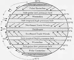
- High latitudes having the high pressure associated with subsiding and diverging winds, experience rather dry conditions.
- The equatorial belt with low pressure and its converging winds, and ascending air receives ample precipitation.
- Cold air has low capacity to hold moisture than the warm air, a general decrease in precipitation is revealed with the increasing distance of latitude from the equator towards the poles.
- Large land masses in the middle latitudes generally experience a decrease in precipitation towards their interiors.
- Windward mountain slopes receive abundant precipitation, while leeward slopes and adjacent low lands fall in rain-shadow.
- The equatorial belt, the windward slopes of the mountains along the western coasts in the cool temperate zone and the coastal areas of the monsoon lands, receive’ heavy precipitation of over 200 centimetres per annum.
- Areas adjacent to the high precipitation regime receive moderate rainfall varying from 100 to 200 centimetres per annum.
- The central parts of the tropical land and the eastern and interior parts of the temperate lands receive inadequate precipitation varying between 50 to 100 centimetres per annum.
- Areas lying in the rain-shadows, the interior of the continents and high latitudes receive low precipitation i.e. less than 50 centimetres per annum
- In some regions, precipitation is distributed evenly throughout the year such as in the equatorial belt and the western parts of cool temperate regions.
- Some of the regions such as monsoon lands and the Mediterranean regions experience seasonal rainfall.
Difference between Rainfall and Precipitation
| Rainfall | Precipitation |
| Rainfall is a type of precipitation when moisture falls on the earth in the forms of drops of water. | It is the collective name given to different forms of release of moisture after condensation. |
| Rainfall is caused due to cooling of saturated air. | Precipitation takes place when the condensation takes place below dew point. |
| Three types of rainfall occurs on the basis of origin : Convectional, Orographic and Frontal | Precipitation has two forms : liquid and solid. |
| When water droplets grow heavy, they fall as rain drops through the clouds. | Rainfall, snow, hail are the common forms of precipitation. |
Types of Rainfall
Rainfall has been classified into three main types based on the origin –
- Convectional rainfall
- Orographic or relief rainfall
- Cyclonic or frontal rainfall
Conventional Rainfall
- The air on getting heated becomes light and rises in convection currents.
- As the air rises, it expands and drops the temperature and subsequently, condensation takes place and cumulus clouds are formed.
- This process releases latent heat of condensation which further heats the air and forces the air to go further up.
- Convectional rainfall is heavy but of short duration, highly localised and is associated with minimum amount of cloudiness.
- It occurs mainly during summer and is common over equatorial doldrums in the Congo basin, the Amazon basin and the islands of south-east Asia.
Orographic Rainfall
- When the saturated air mass comes across a mountain, it is forced to ascend and as it rises, it expands (because of fall in pressure); the temperature falls, and the moisture is condensed.
- This type of precipitation occurs when warm, humid air strikes an orographic barrier (a mountain range) head on. Because of the initial momentum, the air is forced to rise. As the moisture laden air gains height, condensation sets in, and soon saturation is reached. The surplus moisture falls down as orographic precipitation along the windward slopes.
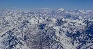
- The chief characteristic of this sort of rain is that the windward slopes receive greater rainfall. After giving rain on the windward side, when these winds reach the other slope, they descend, and their temperature rises. Then their capacity to take in moisture increases and hence, these leeward slopes remain rainless and dry. The area situated on the leeward side, which gets less rainfall is known as the rain-shadow area (Some arid and semi-arid regions are a direct consequence of rain-shadow effect. Example: Patagonian desert in Argentina, Eastern slopes of Western Ghats). It is also known as the relief rain.
- Example: Mahabaleshwar, situated on the Western Ghats, receives more than 600 cm of rainfall, whereas Pune, lying in the rain shadow area, has only about 70 cm.
The Wind Descending on the Leeward Side is heated adiabatically and is called Katabatic Wind.
Cyclonic or Frontal Rainfall
When two air masses with different temperatures meet, turbulent conditions are produced. Along the front convection occurs and causes precipitation (we studied this in Fronts). For instance, in north-west Europe, cold continental air and warm oceanic air converge to produce heavy rainfall in adjacent areas.
- Cyclonic activity causes cyclonic rain and it occurs along the fronts of the cyclone.
- When two masses of air of unlike density, temperature, and humidity meet then it is formed.
- The layer that separates them is known as the front.
- A warm front and the cold front are the two parts of the front.
- At the warm front, the warm lighter wind increases slightly over the heavier cold air.
- As the warm air rises, it cools, and the moisture present in it condenses to form clouds
- This rain falls gradually for a few hours to a few days.
Monsoonal Rainfall
- This type of precipitation is characterized by seasonal reversal of winds which carry oceanic moisture (especially the south-west monsoon) with them and cause extensive rainfall in south and southeast Asia. (More while studying Indian Monsoons).
Types of Rainfall based on Intensity
The types of rainfall based on intensity can be classified as:
- Light rain – Rate of rain varies between 0 to 2.5 millimeters
- Moderate rain – Rate of rain varies between 2.6 millimeters to 7.6 millimeters
- Heavy rain – Rate of rain is beyond 7.6 millimeters
World Distribution of Rainfall
- Different places on the earth’s surface receive different amounts of rainfall in a year and that too in different seasons. In general, as we proceed from the equator towards the poles, rainfall goes on decreasing steadily.
- The coastal areas of the world receive greater amounts of rainfall than the interior of the continents. The rainfall is more over the oceans than on the landmasses of the world because of being great sources of water.
- Between the latitudes 35° and 40° N and S of the equator, the rain is heavier on the eastern coasts and goes on decreasing towards the west. But, between 45° and 65° N and S of equator, due to the westerlies, the rainfall is first received on the western margins of the continents and it goes on decreasing towards the east.
- Wherever mountains run parallel to the coast, the rain is greater on the coastal plain, on the windward side and it decreases towards the leeward side.
- On the basis of the total amount of annual precipitation, major precipitation regimes of the world are identified as follows.
- The equatorial belt, the windward slopes of the mountains along the western coasts in the cool temperate zone and the coastal areas of the monsoon land receive heavy rainfall of over 200 cm per annum.
- Interior continental areas receive moderate rainfall varying from 100 – 200 cm per annum. The coastal areas of the continents receive moderate amount of rainfall.
- The central parts of the tropical land and the eastern and interior parts of the temperate lands receive rainfall varying between 50 – 100 cm per annum.
- Areas lying in the rain shadow zone of the interior of the continents and high latitudes receive very low rainfall – less than 50 cm per annum.
- Seasonal distribution of rainfall provides an important aspect to judge its effectiveness. In some regions rainfall is distributed evenly throughout the year such as in the equatorial belt and in the western parts of cool temperate regions.
Also refer :

